It often happens that parents reduce their preschooler’s acquaintance with geography to only studying maps, memorizing state capitals and memorizing flags. But geography is very vast, has many sections and touches almost every aspect of our lives. This is not only a geographical map...
The concept of geography also includes meteorology, ethnography, geology, ecology, local history, geodesy, geophysics, tectonics and many other related sciences. And this is perhaps the most interesting area of knowledge for a child. After all, any little person is very interested in the structure of the world around him. He is concerned about travel and distant countries, the people and animals that live there. He asks many questions about why earthquakes happen and volcanoes erupt, why the sea always rolls waves onto the shore and why the water in it is salty, what is located underground and at the bottom of the ocean...
Our home is Earth
The baby's first ideas about himself and the world around him are usually very fragmented and unsystematic. Our task as parents is to help the baby realize that every person (including the baby himself) is part of this world. Where to start? First of all, introduce your baby to our amazing planet. Your story might sound something like this: “Every person has his own home. You have it too. You live in it with mom and dad. But all, all people have one more big common home - our beautiful planet Earth. The sky is like a huge blue ceiling, and the ground we walk on is the floor. One big sun shines for everyone. The rain pours on us, like a shower, and the breeze blows across us. A long time ago, many, many years ago, people knew nothing at all about our planet. They thought that the Earth was like a big pancake and lay on the backs of three whales or three elephants, which stood on a giant turtle. When animals began to move, earthquakes occurred on Earth.” Together with your child, you can draw these elephants, and the turtle, and the Earth on their backs and laugh together, because anyone, even the smallest child, knows very well that the Earth is not a pancake, but a huge ball. Of course, a globe will be very useful to you. After all, only with its help will the baby be able to at least slightly imagine what our planet really looks like. Perhaps this is how astronauts from deep space see it. This one is as tiny as a ball.
Ancient people once decided to swim to the ends of the earth. They boarded the ship and after many days of sailing they returned home again, but from the other side. This is how people learned that the Earth is round. Find the point where you live on the map with your baby. Let the baby place his finger on it and, like ancient travelers, move with his finger straight across the globe, without turning anywhere. Came back home"?
Description of planet Earth for children
Earth is not the largest of the planets in the solar system. On the contrary, it is one of the smallest - only Mercury and Venus are smaller than it. But at the same time, the radius of the Earth is 6 thousand 371 kilometers.
The earth is almost perfectly round. At the poles it is slightly flattened. Therefore, two different radii of the Earth are often called: equatorial (in the middle of the planet) - 6378 km and polar (at the “ends”) - 6357 km.
In ancient times, people did not know that the Earth is spherical. They imagined something like a round flat plate. Only after the sailors circumnavigated the Earth and returned to the same place, it became clear that our planet is a ball. Now there is no doubt about it: we have seen many times photographs of the Earth taken from space. By the way, in many photographs the seas, mountains and even large cities are clearly visible.
Earth Rotation
The Earth, like other planets in the solar system, undergoes a complex rotation: around the Sun and around its axis (an imaginary line passing through the center of the planet). Moreover, around the Sun the Earth moves not in a circle, but in an ellipse - this is such an elongated circle.
It is thanks to this rotation that day and night come on Earth, and summer gives way to winter.
Everything is clear with the time of day: day is on that part of the planet that is currently facing the Sun, night is on the opposite. The Earth makes a complete rotation around its axis in approximately 24 hours - during this time a day passes on Earth.
The seasons are more complicated. The Earth makes a complete revolution around the Sun in 365 days. Many people think that the change of seasons is associated with the distance of the Earth from the Sun. But it is not so. The angle of the Earth's inclination relative to the Sun has a much stronger effect on air temperature. The fact is that the Earth's axis (around which rotation occurs) is tilted relative to the Sun by more than 23 degrees. And during rotation, the sun's rays fall on the Earth in different ways. If it’s straight, summer is coming, if it’s at an angle, it’s getting colder. The greater the slope, the colder it is.
The most direct rays fall to the equator, which is why the weather is almost always smooth there, and the extreme points of the Earth - the poles - are so inclined that the sun glides across the surface and does not warm the earth. That's why it's cold in the Arctic and Antarctic even in summer.
How did planet Earth appear?
The child will probably have a question about how our planet was formed. Scientists can only make assumptions on this matter; they do not have an exact answer.
The main hypothesis is that 4.6 billion years ago the Sun arose from a huge gas cloud, and under its influence, the planets of the solar system, including the Earth, were formed from the cosmic dust around. At that time, it bore little resemblance to the planet we live on. Most likely, it was a fireball, which, as it cooled, turned into a stone desert - without water, atmosphere and, of course, signs of life.
Gradually, under the influence of various processes occurring in the depths, various substances rose to the surface. Some turned into water, others participated in the formation of the atmosphere. This happened slowly: scientists believe that the formation of the oceans and surfaces took more than 200 million years.
What is planet Earth made of?
The child will be interested in learning about the structure of our planet. The earth, if you imagine it in cross-section, consists of several layers.
In the very center is the core, solid on the inside and liquid on the outside. Its composition is metal alloys, mainly iron and nickel. The core occupies most of the diameter of the earth, it is the size of the planet Mars. There is an inner and outer core. This part of the earth is very hot, and the deeper it is, the hotter it is. It is impossible to reach such a level, but, according to scientists, the temperature inside the core can be higher than in the Sun - up to 7 thousand degrees.
Above the core is the mantle. This is the most important layer of the Earth - and the largest (over 80% of the total volume). This is where most of the substances that make up the Earth are concentrated. These are mainly iron compounds, but the structure of the layer is not entirely solid: the mantle is rather viscous, so it is often said that the earth's crust “floats” on the mantle.
The earth's crust is the upper part of solid earth. Compared to other layers it is thin. There is continental and oceanic crust. The layer of continental crust reaches 40–50 kilometers, and under the oceans - 5–10. The crust makes up about 1% of the Earth's mass.
The earth's crust and upper mantle are called the lithosphere.
And the hydrosphere is the entire water part of the Earth’s surface, which includes the World Ocean, waters and glaciers, and groundwater.
It turns out that for a surface covered with water, the hydrosphere is located above the lithosphere.
Even higher is the atmosphere. This is no longer part of the planet, but its gas shell, which is located above the Earth and rotates with it.
The composition of the earth's atmosphere, and more specifically the oxygen content in it, played a key role in the emergence of life on Earth.
In addition to oxygen, nitrogen and other gases are present in the Earth's atmosphere. And thanks to the ozone layer in the atmosphere, the Earth is protected from most of the sun's ultraviolet radiation.
Where does Carlson live?
The sooner a geographical map appears in the baby's room, the better. Don’t think that your baby won’t understand or remember anything. It is enough just to draw the young geographer’s attention to the map from time to time, show and name geographical objects, and very soon the child will know parts of the world, oceans, and even many countries with their capitals.
And diverse children's literature is a real treasury of geographical knowledge. And the more we read to the baby, the broader his ideas about the world around him will be. And not just read, but definitely look on the map for the places where events take place. For such games, it is most convenient if the card hangs directly above the child's bed. So, reading about Carlson’s antics, let’s find the country of Sweden and remember its capital - Stockholm. Getting acquainted with the book about the onion boy Cipollino, we will find on the map his homeland - Italy. We’ll also find out where the mischievous Pippi visited during her sea voyages with her captain dad. Especially good is a children's map of the world with all sorts of biological, historical and fairy-tale object-icons. Kids love to look at them, at the same time memorizing a lot of useful information. But an ordinary physical map of the world or a map of the hemispheres will also work. And it’s easy to make a “developmental” card yourself from the most ordinary one. You can paste stickers and pictures with animals and fairy-tale characters onto images of continents. For example, we will place a sticker with the characters of the cartoon “Madagascar” near the island of the same name. And at the same time, we’ll find something interesting in the encyclopedia and read something interesting about this island with our kids. And let's not forget to follow the path of Marty the zebra and her friends from New York to Madagascar. If you find old magazines or atlases from which you can cut out flags of different states, stick them on the map along with the crumbs. Such games will bring undoubted benefits to the baby and will greatly facilitate further schooling.
Kipling's tales will perfectly acquaint the little geographer with the animal world of India. Let the baby remember the location on the map of this country. Travel across the map with Doctor Aibolit, who went to Africa to treat sick monkeys, and with Nils and a flock of geese. When the baby grows up a little, read him a fairy tale about the adventures of Captain Vrungel. It is simply replete with all sorts of geographical details. Of course, don’t forget to find on the map all the places where the brave captain visited on his famous yacht “Trouble”. Better yet, mark his path with a pencil directly on the map. In general, make it a rule to refer to the map in all cases when in everyday life we are talking about some geographical names, be it reading books, watching cartoons, or telling stories to friends who have returned from a trip. This will help the baby remember a lot of useful information and teach him how to use the map. And all this is practically effortless, as if by itself.
Conditions for classes
In order for geography classes to be successful, it is necessary to take into account the child’s characteristics:
- fatigue;
- heightened sense of self-esteem (at a certain age);
- interest in acquiring knowledge through play;
- the need for your encouragement (verbal).
Based on this, we can conclude about the peculiarities of conducting classes:
- lessons should be short (5-10 minutes);
- you need to trust the child without checking how he has acquired knowledge;
- the lesson should be prepared in advance and interesting, take place in a playful way, with bright, visual materials on geography;
- Praise your child for his interest in activities.
The child needs to be interested in what is being told to him. Geography is an unfamiliar subject for two-year-old children, so you shouldn’t expect specific questions on a variety of topics on the subject.
You can pick up on a third-party question that interests you and develop the topic in the direction you need. Questions should arise from the child after becoming acquainted with a new phenomenon or previously unknown object that captured his imagination.
Watching nature programs on TV is not the best way to introduce geography to a one and a half year old child.
In this case, you are more likely to introduce him to the TV.
It’s better to take him to nature, where there is a varied landscape, a river flows or fields lie. Let him feel the beauty that surrounds him, see the blue sky, the distant horizon. Tell your child that there are other countries far beyond the horizon. That getting there is not at all as easy as it seems.
The child will become familiar with many concepts of physical geography after such a walk. For children four years old and older there are interesting series of cartoons: “Geography for Kids”, “Why”, etc.
In order for your child to have questions, you can buy interesting children's games, toys, magnetic cards, and beautiful pictures on a geographic topic. Using pictures, it is necessary to explain to a child the natural phenomena of the surrounding world, which is studied by physical geography, from the age of one and a half to two years.
The way children absorb information is very interesting. They believe everything unconditionally. Especially if the narrator’s authority does not raise any doubts in their minds. Children are very easy to deceive. Therefore, if you don’t know something, don’t answer the question with nonsense, ask your child for time to think.
Kids get tired quickly. They are unable to study for long periods of time. There is no need to drag out a fascinating story because you are very interested in finishing it. Keep it short, simple and clear. It’s another matter if children are interested in geography, and they themselves ask to talk further.
Usually, kids focus their attention on one object for no longer than five or ten minutes.
Expect to fit your geography lesson in around this time. This requires advance preparation and a thoughtful plan. It is advisable to conduct daily home exercises at the same time.
To teach your child to notice and comprehend the world around him while studying geography, communicate with him on a walk, showing and naming objects and phenomena.
In the footsteps of Cecile Lupan
Many interesting geographical ideas can be gleaned from the book Believe in Your Child by Cecile Lupan. First of all, these are songs with the names of state capitals. You can tell your baby rhymes or sing songs that mention geographical names. After all, in poetry such information is remembered much easier. Here are some examples:
We soar over Italy, We see the eternal city of Rome. And in Spain - Madrid stands in the center of the entire country. Here in France, in Paris, the Tower of all buildings is taller! And in Britain, without a doubt, London is the most important city.
It would be great to read with your child A. Usachev’s wonderful book “My First Geographical Discoveries”, where geography is studied in poetry and is very fun:
There are many islands in the world, So many that you can’t count them... But we can count six large continents: Africa, America (North and South), Australia, Eurasia, Antarctica (Blizzard). What is Eurasia? This is Europe plus Asia: The largest continent arose from two parts of the world!
Geography for kids
in fairy tales, riddles, drawings, assignmentsExclusive publication!
Quantity Leave your comment
SHARE
From the author. You can travel in different ways, everyone knows that. You can take your dad or mom by the hand and go for a walk around the city on Sunday and experience many adventures: eat a big ice cream, ride a carousel, visit a museum where it’s quiet and cool, and there are paintings on all the walls.
You can pack your suitcase and go to your grandmother’s village in the summer. You can watch a television program where men and women talk about distant countries and show what they managed to film on a video camera.
You can also travel thanks to your imagination and books. Many children love to read about distant cities and countries, about the people and animals that live there, about the holidays that are celebrated there. And for such inquisitive children - our entertaining geography lessons with geo-fairy tales, geo-riddles, geo-drawings and geo-tasks.
First lesson. How the towers quarreled Geo-tale about the Berlin, Eiffel and Ostankino towers. Geotasks.
Lesson two. Afonya's travels (part 1) Geo-tale about Central Asia, yurt. Geotasks.
Lesson three. Afonya's travels (part 2) Geo-tale about the North of Russia (chum), about North America (wigwam). Geotasks.
Lesson four. Afonya's travels (part 3) Geo-tale about the Far North (igloo), about Russia (izba). Geotasks.
Lesson five. Registan Square Geo-tale about Uzbekistan, Samarkand. Geotasks.
Lesson six. The Tsar and the Cactus Geo-tale about Mexico and Russia. Geotasks.
Lesson seven. Friendship is not afraid of anything Geo-tale about volcanoes. Geotasks.
Lesson eight. Let's look for the sea! Geo-tale about the Lena River. Geotasks.
Lesson nine. Happy earthlings Geo-tale about races and nationalities. Geotasks.
Lesson ten. Why does Mercury need flax? Geotale about the planets of the solar system. Geotasks.
Lesson eleven. Harmful fog Geo-tale about St. Petersburg. Geotasks.
Lesson twelve. Who eats what? A geo-tale about a spoon, fork, knife and chopsticks. Geotasks.
Lesson thirteen. The most dangerous Geo-tale about the inhabitants of the Amazon: crocodile, anaconda, piranhas. Geotasks.
Lesson fourteen. Birthday Geostory about the city of Riga. Geotasks.
Lesson fifteen. The highest Geostory about mountains. Geotasks.
Lesson sixteen. Letter to Santa Claus Geo-tale about a letter to Veliky Ustyug. Geotasks.
Lesson seventeen. Snowflakes in Paris (part 1) Geostory about Montmartre. Georeference.
Lesson eighteen. Snowflakes in Paris (part 2) Geostory about the Eiffel Tower. Geotasks.
Lesson nineteen. Snowflakes in Paris (part 3) Geo-tale about the Louvre. Geotasks.
Lesson twenty. Day and night Geo-tale about the change of day and night. Geodictionary. Geospecification.
Lesson twenty one. How the Moon appeared Geo-tale about the Moon. Geodictionary. Geospecification.
Lesson twenty two. Moon or month? Geo-tale about the phases of the moon. Geodictionary. Geotasks.
Lesson twenty three. Beauty Geo-tale about St. Basil's Cathedral, about the Kremlin. Geotasks.
Lesson twenty-four. Gift Geo-tale about Oslo museums. Geospecification.
Lesson twenty-five. Gift of the Earth A geotale about the seasons. Geotasks.
Lesson twenty-six. Cloud Inhabitants Geo-tale about different types of precipitation. Geodictionary. Geospecification.
Lesson twenty-seven. There is no dispute about tastes Geo-tale about Dutch artists. Geodictionary. Geospecification.
Lesson twenty-eight. I want to go to the museum! Geo-tale about Greece, Athens. Geodictionary. Geospecification.
Lesson twenty-nine. Big Berliner Geo-tale about Germany, Berlin. Geodictionary.
Lesson thirty. Mountain Geo-riddles about the slope, peak, peak, base of the mountain. Geodictionary. Geotasks.
Lesson thirty one. Mood of nature Geo-tale about the weather. Geodictionary. Geospecification.
Lesson thirty two. The Writer and the Little Mermaid New! A geofairy tale about Copenhagen, the capital of Denmark. Geodictionary. Geotasks.
To be continued.
© The author of the original idea, texts, poems, drawings and assignments is Svetlana Wiederhold, especially for the portal “Sun” - solnet®.ee The text is published in the processing of Tatyana Evtyukova
See also:
- Geography quizzes with answers
- Geography for kids An educational and educational cartoon tells kids about the continents and parts of the world, about mountains and waterfalls, about seas and oceans, about rivers and lakes, about the change of day and night, about the water cycle in nature...
- Photo trips: expanding your horizons Do you want to take a virtual trip to the Land of Chocolate, to Santa Claus, to Disneyland, to Legoland, to London or to Guinea-Bissau?
Comments on the publication Geography for kids 04/01/2005, 01:58 pm (10/28/2004, 09:50 pm)
Very interesting and educational, children perceive the game more easily. Thank you.
01.04.2005, 13:59
28.10.2004, 22:30 ()
Amazing!!!!! May good ideas continue to follow.
01.04.2005, 14:00
(29.10.2004, 16:50)
super looking forward to the continuation, but you can also insert photos of these towers, then all you have to do is print it out and go ahead. so I'll go look for towers
01.04.2005, 14:00
(30.10.2004, 17:59)
The whole family is delighted. Thank you.
01.04.2005, 14:01
(04.11.2004, 10:44)
Great! Now I can read your geo-tales on my favorite website! Thank you! Your fan.
01.04.2005, 14:01
(04.11.2004, 20:27) Marine
Spasibo bol»shoe, jivu v Meksike y ispol»zuiu material dlia moix urokov rus. v universitete.Naslajdaius" kajdoy vashey stranichkoy!!!!Sneterpeniem jdu novix.
01.04.2005, 14:02
(08.11.2004, 15:40)
My children (I have two) are waiting for the second lesson. I believe that through play it is easier for children to remember serious (“adult”) facts. Thank you.
01.04.2005, 14:03
(17.11.2004, 11:48)
01.04.2005, 14:03
(19.11.2004, 19:19)
I really liked both the trip and the drawings. I wonder what will happen next. I'm looking forward to the continuation.
01.04.2005, 14:04
(25.11.2004, 14:03)
I really like all your sections and geography too. My child is 3.5. We discuss your fairy tales. We have a map hanging in our house and the child already knows many countries and shows them. We know one song that may be useful to you. A song about the countries of Europe: We are sitting on a plane, We will fly all over Europe, Let’s see now what we have in the west. Here in France, in Paris, the Tower of all buildings is taller! And in Germany, in Berlin, there is a wonderful menagerie. The city of Bern in the mountains of Switzerland Aare stands on the river. People in Belgium, in Brussels, knew how to weave lace. And in Britain, without a doubt, London is the most important city. Further - to the Netherlands, where the Wind dries Amsterdam. So they looked to the west and flew to the north. The Danish city of Copenhagen is famous for its mermaid girl. In Sweden, Stockholm is the capital and looks into the waters of the Baltic. The city of Helsinki among the Finns lies in the lowlands near the sea. Tall Norwegian ships are sailing to the city of Oslo. Time flies quickly, Our path lies to the east. The country of Russia is great, Moscow is the most beautiful in it. All of Romania is proud of Bucharest as its capital. In Poland, the majestic city is called Warsaw. And in Bulgaria, in Sofia, the Temple of Wisdom - Sofia. Astronomer Tycho Brahe is remembered in the Czech Republic and Prague. Budapest is Hungarian, know that the Danube looks blue. And the Austrians certainly go to Vienna to listen to songs. To complete the circle, we head south. We soar over Italy, We see the eternal city of Rome. In warm Greece, in Athens, there are many ancient statues. The Portuguese is in love with his port of Lisbon. And in Spain - Madrid stands in the center of the entire country. Thank you very much for your work! Tai's mom.
01.04.2005, 14:05
(25.11.2004, 14:17)
Very useful lessons, but... you can do without brownies and so on...
01.04.2005, 14:05
(14.12.2004, 08:37)
Everything is built in game forms and it makes me happy. And we play and remember, even if not everything is immediately remembered, but, as they say, “the grain falls into favorable soil” and subsequently sprouts. THANK YOU for caring about our children. Happy holiday and GOOD SUCCESS.
01.04.2005, 14:06
(27.12.2004, 14:59)
Our daughter is 5 years old, we liked it. When will there be a sequel?
01.04.2005, 14:06
(22.01.2005, 23:24)
Great idea! Wonderful tales! Great assignments! Thank you very much! Please tell us about volcanoes. My six-year-old daughter is very interested in them, but I can’t find accessible and interesting material anywhere. Thank you.
01.04.2005, 14:07
(12.02.2005, 17:34)
Very beautiful fairy tales. I look forward to the continuation, I hope to learn about Japan, I really like the journey through your page!!!
01.04.2005, 14:08
24.02.2005, 20:09 ()
Class!!!!!!!!
04/01/2005, 14:08
(03/06/2005, 15:06) M
Thank you very much! I found what I wanted from you. I have three children of different ages (5-3-2 years old), everyone listens with great pleasure. We are waiting for new stories.
01.04.2005, 14:09
(11.03.2005, 22:02)
Thank you very much for the interesting stories, and a special thank you to Irina (11/25/2004) for the “song about European countries.”
01.04.2005, 14:09
(16.03.2005, 11:06)
Thank you very much for these articles. My six-year-old daughter Veronica loves to read them and solve geotasks. We look forward to the continuation.
01.04.2005, 14:10
(17.03.2005, 12:28)
The possibilities for this idea are almost endless. Super!
01.04.2005, 14:10
(23.03.2005, 11:02) ()
Good ideas...
04/01/2005, 14:11
Elena
Wonderful! Interesting, and most importantly easy to understand. I especially liked the riddles in verse. Thank you.
04/18/2005, 15:26
Love
Surprisingly simple and informative. It’s so easy to talk about complex things...You, Svetlana, are simply talented!!! And most importantly, thanks to this wonderful site, it is available to those who care about the coming generation.
04/24/2005, 06:07
Neustupova Ekaterina
I use your fairy tales-tasks in the senior preparatory groups of kindergarten, I would like a somewhat simplified version for this age. Thank you!
04/26/2005, 14:37
Lena
simple and fun
04/30/2005, 21:57
Plyushkin
Yes, professionally...
05/12/2005, 14:11
Konotopenko S.G.
Thank you very much for the stories. I really like them and my kids absolutely love them.
05/14/2005, 16:09
Olga
very cool! I am a geographer myself, so this is a very close topic. My son is still very small, when he grows up, we will definitely read your fairy tales with him! Thank you!!!
06/05/2005, 16:47
Elena
Wonderful!
06/09/2005, 12:51
Vita
a very necessary section, informative, well done, the creators, thank you and God grant you many more interesting projects
06.16.2005, 18:52
Lera, 8 years old
06.22.2005, 16:31
Tan Dima and I
read a fairy tale about the planets - the child laughed out loud!
06.24.2005, 20:17
Elena
I read a fairy tale about fog, and I didn’t want to be mischievous. Thank you.
07.17.2005, 17:46
Elena
Again I re-read the fairy tales, kind and understandable. Thank you. I'll be waiting for the continuation.
09.13.2005, 14:12
Oksana
Thank you very much, the story about the planets is simply a miracle, but my child (5 years old) had a reasonable question: What about the Moon? We are waiting for the continuation about the Moon. Thank you
09/20/2005, 11:10
Elena
10/19/2005, 10:17
Olga Anatolyevna, Marina Olegovna, Irina
We are longtime fans of your portal, but we were very surprised by the interpretation of the division of the Earth's population into races, presented by S. Belokurova-Wiederhold. Where did the Caucasian race go? race? Unprofessional and opportunistic.
10.19.2005, 18:08
author of geofairy tales
Dear readers! There has always been controversy about the concept of “race” in science. The most common classifications are: Caucasoid, Mongoloid and Negroid races. They, in turn, are divided into subgroups. I used one of the European qualifications, which, however, can also be found in modern Russian-language reference books: three main races – Negroid, Mongoloid and Caucasian (where “Caucasian” corresponds to “Caucasian”). So, there is no mistake in the fairy tale.
10.29.2005, 21:36
Lena
11.28.2005, 19:33
nana
otlichno
01.12.2005, 11:43
Ekaterina
The lessons are wonderful, but is it possible to post the answers somewhere? I'm not very good with puzzles myself.
08.12.2005, 14:44
Svetlana
My child and I really like GeoFairy Tales. Many thanks to the author Svetlana Belokurova-Wiederhold. I want to talk about poems to the author of the comment from 04/01/2005, 14:04 Irina: Do you have poems about other countries and capitals. I would be very grateful if you provide information about them. To the site administrator: You need to correct the title “LESSON ELEVEN” in the text of the fairy tale “Who Is What” to “LESSON TWELVE”, so it would be more correct in number. Thank you very much.
08.12.2005, 14:55
Site administrator
Svetlana, thank you for writing. The typo has been corrected.
12/17/2005, 18:32
Denis
what is geography
12/19/2005, 10:41
author of geotales
Answer to Denis's question: Geo (from the Greek ge - earth) - indicates an attitude towards the sciences of the Earth, the earth's crust and the globe as a whole. Graphy (from the Greek grapho - I write, draw, draw), in this case, the name of the science that studies, describes the subject indicated in the upcoming part (here: geo). So it turns out that geography is a science that studies and describes the globe as a whole. It is divided into dozens of “narrow” geographical sciences, which concentrate their attention on one subject. For example: geology, economic geography, population geography, geography of a country or region (geography of Russia, geography of the Urals).
12/23/2005, 20:10
Elena
Very interesting, we are waiting for the continuation, Thank you very much for your fairy tales. Merry christmas and a happy new year! Good luck!
02/27/2006, 19:00
Nadezhda
Thank you, my son and I read your fairy tales with pleasure.
03/01/2006, 22:39
Alisa
I really liked the story about Paris, especially the main characters. I find a lot of new, and most importantly interesting and easy to remember things in your fairy tales. Thank you.
03/01/2006, 22:45
Elena
Nice story with snowflakes. I liked it very much!!!
03/24/2006, 11:43
Nadezhda
I really liked the wonderful geography lessons at Solnyshka. I studied all this myself at school and I know all this. However, it was the “Sun” portal that helped explain this to my younger sister, who constantly asks questions about the topics of geographical lessons. Thank you!
03/27/2006, 16:24
Yasya
is very interesting
05/10/2006, 15:30
Evelina
Svetlana, thank you! All fairy tales go with a bang! Are you planning to publish all these fairy tales in book form?
05/21/2006, 12:53
Editor of the portal “Sun”
Geotales are planned to be published in printed form, follow the announcements on the website.
08/29/2006, 08:39
Maria
Dear Svetlana, you are a very talented person! Thank you. Good luck and inspiration to you!
09.15.2006, 19:58
NatalieSerge
Thank you, Svetlana! Very interesting, I’ll try to include the material in the program on the subject of the World around us at the early development center. I would just like to know what age the material is intended for. Wishing you further creative journey!
11/23/2006, 09:41
Svetlana
Everything is great here! Thank you.
01/24/2007, 14:02
Alexander
Everything is fine. I kindly envy the citizens of Russia. You have enthusiasts who care not only about filling their pockets, but also about their children, about the future. Not like in Ukraine...
02/11/2007, 16:27
Editor of the portal “Solnyshko”
There is no point in envying Russian citizens in this case. The author of geofairy tales lives in Germany. The editorial office of the portal “Sun” is in Estonia. And on the Internet, the material is available to everyone, regardless of their country of residence. Stay with us!
03/21/2007, 12:06
Olga
08/14/2007, 17:05
Tanya I
just discovered fairy tales!!! The child is 3 years old. We read lesson 1, I added a photo of the towers + the Leaning Tower of Pisa to the lesson (I really love it). For the second lesson I wanted to recommend a link with photos, but for some reason I can’t
08/16/2007, 22:05
Elena
08/31/2007, 16:27
Anna
A wonderful fairy tale about Moscow. Thank you!
03.09.2007, 20:43
Peter
5+
09.18.2007, 08:14
Guyans
Well done! Great idea! Children will read with pleasure, and they will also gain knowledge, because the situation with the towers is so similar to their quarrels and reconciliations.
02.10.2007, 13:31
Anna
A wonderful fairy tale. THANK YOU.
10.11.2007, 19:39
Lena
Beauty!!!
10.29.2007, 20:23
Svetlana
Thank you! Very necessary material, and on time. I wish you to develop as many such lessons as possible. 29.10 07.
12/18/2007, 11:43 pm
Ekaterina
thank you. Only photos are really needed here
02/13/2008, 09:49
Nadezhda
Thank you very much for the fascinating lessons, very informative and well received by the child.
02.23.2008, 14:26
[email protected]
I have been looking for fairy tales for children on geography for a long time. I work in a kindergarten with children aged 5-7 years. Geography interests them very much. THANK YOU!!!
04/02/2008, 19:35
Lena
people send more crossword puzzles and tiki with puzzles
04/02/2008, 19:38
Lena
wow wow wow wow wow wow wow wow wow wow wow wow wow
04/15/2008, 15:03
Love
Simply wonderful. Everything is so simple and interesting. Thanks for the find.
04/18/2008, 10:26
Luali
Played a game with my class. It was great! Thank you.
04/27/2008, 13:48
Mili Mu Mili Du
Even though I’m in fourth grade, I read everything from beginning to end with interest! Hello, “SUNNY”!!!
08/19/2008, 21:17
Alena
11/20/2008, 10:02
Valentina
Thank you very much for such an interesting site! It makes it so easy to prepare your child for school. Well, geofairy tales are just super
26.11.2008, 14:53
Svetlana
Your site is just a find, super, there is no better one!!!
12/01/2008, 08:46
Svetlana Anatolyevna
A LOW BOW to you!!! Thank you from the entire city of Pavlograd (Ukraine), and especially from the children and parents of school No. 12. It would be great if they created a training video.
09.12.2008, 17:37
Natalya
Thank you very much! Your geo-tales really help my students understand geography. Thanks for the help!
12/19/2008, 02:10
Alina
Thank you so much!!!!!!
12/20/2008, 6:28 pm
Elena Krampets
01/28/2009, 8:25 pm
Nadezhda
Excellent material for lessons about the world around us.
01/30/2009, 08:52
Tatyana
Thank you very much! Very interesting tales and tasks! Both my 8-year-old son and my 1.5-year-old daughter listen with pleasure. And even my husband!
01/31/2009, 10:29
Olya 6 years old
I don’t like to study, but it’s a pleasure to study in this Virtual School!!!
02/09/2009, 12:30
anna
wonderful fairy tales
02/09/2009, 12:31 pm
Brenda Still
is amazing!!!!!!!!!!
02/13/2009, 11:41
Ksenia.
Kharkov AMAZING!!!!!!!!!!!!!!!!!!!!!!!! AND THIS IS NOT ONLY FROM MY DAUGHTER, BUT ALSO FROM ME. THANK YOU!
02/18/2009, 22:07
Svetlana
Thank you, very interesting classes
02/19/2009, 11:09
Oksana
very interesting and most importantly accessible for children, they really like it
03/12/2009, 14:29
Elena
Wonderful lessons, I downloaded them and will be happy to read them to my son and complete the assignments. True, I haven’t found any recommendations for what age, but we’ll still selectively try to learn new things.
03/13/2009, 18:01
Julia
I really liked your lesson, thank you!
03/28/2009, 18:43
Zyure Ismailovna
Very interesting technique. But please tell me what age is it intended for? FOR preschoolers, solving crossword puzzles is a difficult task. It is recommended for 1st grade students. In addition, preschoolers will not understand what the 14th-17th centuries mean. We explain to them that this was a very long time ago. I recommend explaining what the names of the madrassas mean. Tillya kori - gilded. Sher Dor - madrasah with tigers. When talking about the ornament, pay attention that the designs are all different and are not repeated. I was born and lived until I was 15 years old in Samarkand. Mom was a tour guide. Therefore, I know a lot about history. Currently I am the head of the department of preschool pedagogy at the Crimean Engineering and Pedagogical University in Simferopol. I will be glad to cooperate!
04/02/2009, 13:30
Denis
04/03/2009, 18:44
Julia
super and class
04/10/2009, 18:08
Julia
A good story about the planets of the solar system.
04/13/2009, 18:08
Svetlana
04/13/2009, 18:34
Svetlana Wiederhold
Thank you very much for your feedback! Inspiring! Regarding cooperation, comments can be written to my address: [email protected] See you next time at the virtual school!
05/14/2009, 20:07
Ekaterina
Thank you for your portal. Your virtual lessons are great!
05.15.2009, 15:15
Valeria
cool I liked everything
05/23/2009, 17:06
Bitno Galina
I work with kids, teach them reading and mathematics, I really like your creative approach to the development of children with the help of geofairy tales. She has written developments for reading lessons for children, including ones based on biology. I would like to work similarly in geography. Sincerely. Galina.
05/24/2009, 23:37
Editor of the portal “Solnyshko”
Galina, would you share your experience and send your developments for publication on the site! A?
05/27/2009, 10:28
Olga
Thank you for your help in the development of the future generation!!!
05/29/2009, 16:14
Julia
the story about fish is cool.!!!!!!
06/04/2009, 12:26
yuliya
cool!! I'm really looking forward to the next lesson!!
06/05/2009, 10:41
Julia
very interesting story thank you!!!!!
06/27/2009, 21:37
Snezhana
Cool! Both education and entertainment! Thank you!
08/26/2009, 16:21
Julia
The story about day and night is good
08/30/2009, 15:00
Irina
Thank you very much for your kind and sensitive attitude towards geography. If possible, then write a geofairy tale “The Journey of a Droplet” or “The Journey of a Grain of Sand”, I think it will be interesting for children to compare your version and theirs, because such an assignment is in school program.
10.10.2009, 16:49
Alena
Hello. I would like to express my HUGE THANKS to this site for such beautifully selected material. I am an economics teacher and the fairy tales from the ECONOMICS FOR KIDS section were very useful. But I am also a music teacher and it would be great if there was a section dedicated to music. Thank you very much.
10.22.2009, 16:15
Elena
Very interesting for both kids and parents! It's good that I found out about your existence! Thank you!
07.11.2009, 20:40
Tamara
Thank you very much! I myself am a geographer by training, I am very glad that I will be able to tell my child about this wonderful science in a fun way.
12/06/2009, 18:12
Marina
, it’s a pity that our teachers don’t do anything like that in schools, maybe. children were more willing to study and knew geography better
12/10/2009, 13:07
Lena Gizatullina
Very interesting and educational, continue to make us and our children happy. We are looking forward to the continuation. Well done!!!!
01/03/2010, 22:52
Polik
I liked the first and twelfth!
01/08/2010, 17:09
Evgeniya
Thank you.
01/30/2010, 06:36
Svetlana
02/05/2010, 13:23
Ekaterina
This is just super!!! You are so great!!! We look forward to the continuation. Thank you very much for your work!!!
02/16/2010, 16:58
gave
good lessons
03/16/2010, 15:56
Anya (schoolgirl)
I really liked all the stories; if I’m already 14 years old and I’m also interested, I don’t even know how interesting it is for children younger than me)) thank you)))) Bravao)) for an encore)) )
03/28/2010, 12:31
nettle
Marktus was real, unlike anyone else, and even without chips in the thorns. These are the people who scold us...
03/30/2010, 15:14
[email protected]
Great, thank you. You are smart!
04/28/2010, 16:06
Angelina
Thank you so much, your classes are just super!!!
05/11/2010, 19:43
Eusevia
This is all just wonderful!!! I’m going as a counselor to a children’s camp with a geographical focus, and this is exactly what I was looking for!”!!
06/28/2010, 17:00
Natalya Akhryomochkina, teacher at Vysheslavskaya school. Ya.O
Svetlana, thank you very much for such interesting lessons, I looked at many things differently, I will definitely use them in my work. Creative success!
07/12/2010, 11:51
daughter Aisha
is super
09/03/2010, 10:56
LYUDMILA
EVERYTHING IS GOOD, INFORMATIVE, BUT THIS IS THE FIRST TIME I HEAR THAT THE CAUCASIAN RACE BELONG TO RUSSIANS, GERMANS, AND ENGLISH. IT NEEDS TO BE FIXED!
09/06/2010, 13:42
Editor of the portal “Solnyshko”
Lyudmila, just because YOU are hearing about this for the first time does not mean that it is not so and that “it needs to be corrected”. The Caucasian race is the same as the Caucasian, Caucasian (from the English Caucasian race) or Eurasian. Look in the literature or on the Internet if you still have doubts.
12/04/2010, 05:02
Larisa
super super super!!!!!!great!!!!I also want to talk about Japan!!! and in general it is very!!!interesting!!!!
01/13/2011, 15:23
Baba Olya
this is very interesting
01/13/2011, 15:30
Dasha
This is very interesting since I am a geologist myself.
01/30/2011, 08:42
Julia
I really liked it.
02/13/2011, 16:13
Maria
liked it
02/23/2011, 14:05
Filyuza
THANK YOU!!!!!!!!
02/24/2011, 11:40
Elena
It seems to me that in the first lesson we need stories about either towers or cities, so as not to confuse the child. The capital and the child are in “shock”! Maybe I'm wrong?
03/16/2011, 11:52
Librarian
03/17/2011, 15:23
Dasha
tse duzhe tsikavo since I’m a geologist myself
03/18/2011, 21:55
Tamara
wonderful tales, thank you
04/04/2011, 21:17
Valentina
Wonderful, educational fairy tales, in an accessible form for children. Thanks a lot!
04/08/2011, 19:40
Zhenya
Interesting Little Thing I really really really liked the assignments Just well done
04/09/2011, 18:17
Svetlana
Thank you so much! Super!!!
04/17/2011, 19:23
Olga
Thank you for your work!. Very interesting material
04/18/2011, 11:27
Albina
Svetlana, thank you very much....Your wonderful stories are a godsend for us mothers and a special interest for our kids....
05/06/2011, 11:29
perepechina lyudmila
I really liked it! Can be used in lessons!
05/26/2011, 23:24
Julia
Thank you so much for your work!
05/31/2011, 21:16
flomi
superrrrrrrrr-duperrrrrrrrrrrrrrrrr. Not a fairy tale, but some kind of educational lesson!!!
02.06.2011, 22:39
great!!!! Thank you very much
08/17/2011, 09:47
Elena
Svetlana, you are just smart
05.11.2011, 15:16
Olga
Svetlana, THANK YOU for the amazing, interesting tales! We are waiting for the continuation. Write a fairy tale about Baikal for us!
11/12/2011, 12:15
Zoya
is great, my daughter now knows about towers and cities, thank you, let’s continue the lessons
03/18/2012, 10:19
Elena
Thank you very much for the excellent material! Good luck with your next projects.
05/02/2012, 18:27
Yulia Gennadievna
Very wonderful lessons, informative, just super! I work as a teacher, and I want to use an intellectual circle in my circle work. I'm just delighted!
05/06/2013, 21:43
KatrinaZ
Just lovely! Thank you very much for the fairy tale!
01/31/2014, 06:00
kunakbaeva elsa
Hello! Thank you very much for the interesting and educational material using multimedia technology.
02/04/2014, 10:37
Raila Ziatdinova
thank you very much. super material.
02/18/2014, 06:52
Maria Lyamina
You are doing a great job! Thank you so much, this is something you can't find anywhere!!! I have been looking for such interesting and accessible information on geography for almost half a year!!! And most importantly, exciting!
02/18/2014, 12:22
Kira
Good afternoon! We started reading your fairy tales, the children listened with interest, but in the third fairy tale it struck a chord: the country of America. I'm not a geographer, but there is no such country, correct it to the mainland, please!
04/19/2014, 11:35
Tatyana
Very interesting! It's impossible not to remember! Thank you!
05/15/2014, 19:23
Anna
I would like to add pictures. And so great.
08/17/2014, 15:23
Zinaida
Svetlana, I am very grateful to you and the organizers of the site for such wonderful material.
10/18/2018, 11:07 pm
Natalya
Thank you! Wonderful tales!
02/08/2021, 10:25
Nastya
Fairy tale - super! for the rebus the solution is = chum. We just go through it at school!
12/08/2021, 00:35
art-iq.com.ua
Thank you! Wonderful tales!
Colored seas
Your little one probably already knows that rivers, lakes, seas and oceans are indicated in blue on the map. You can start getting acquainted with the planet’s water resources with the “colored” seas. The kid will be interested to know that on our planet there is a Black, Red, White and even a Yellow Sea. Find them on the map and try together to figure out why these seas have such unusual names. The Yellow Sea has a yellowish tint. The Red Sea is home to special algae. During periods of their intensive growth, it seems that the blue water surface is painted in red-brown tones. The White North Sea really has a very light, almost white color of water. And the Black Sea has long been nicknamed this because of the restless nature and black color of the water during storms and storms.
Or maybe the baby will want to draw these colored seas? What countries are they located near? What kind of people live there? Perhaps your baby has already visited one of these seas (for example, the Black or Red) or you are about to go on a trip. Then he will be doubly interested in learning more about these amazing seas.
And then find it on the map and look at other seas. And also try to understand the origin of their names. This will not only expand the child’s geographical knowledge, but also train his thinking, ingenuity and imagination. After all, you can put forward fantastic versions. And then, together with your mother, find information in a children's encyclopedia or on the Internet and check your guesses. After all, why the Mediterranean Sea was called that way, the child will probably guess for himself. You just need to look carefully at the map. The Sea of Japan and South China Sea, for example, will not cause any difficulties. But you will have to think about the origin of the name of the Dead Sea.
Subject of study
Geography conveys knowledge about planet Earth to children from an early age in a simple and accessible form. It includes elements of physical, socio-economic, political geography, a little geology, botany and zoology.
It is necessary to proceed from the needs of a particular child, making a greater bias in one direction or another. What is a four- or five-year-old child studying children's geography familiar with?
- He is familiar with the globe and the map depicting the planet on which he lives.
- Distinguishes continents, oceans, seas, and parts of the world on a globe and map.
- Knows various forms of relief and natural areas: plains and mountains; forests, steppes, deserts, rivers.
- Distinguishes the change of seasons, months and time of day.
- Knows the names of the cardinal directions - north, south, west, east, their position on the map and on the ground.
- Familiar with six continents and four oceans. Knows about the differences in climate on different continents, the unique flora and fauna.
- Has an understanding of the existence of different countries in which people of other nationalities live with their own customs.
Can show several countries on a map and knows their capitals. The kid was told briefly about the most interesting and unusual things (sights, holidays, people, national dishes, fairy tales).
If you are studying geography with your child, try to adhere to this plan for presenting knowledge.
The youngest children, one and a half years old, need to be interested in learning. Learn to ask questions and see the beauty around you. Know what sand is, what earth is. Why does grass grow, what color is it, etc.
d.
Geography on a walk
Where is the best place to study Earth Science?
On a walk, of course. Better yet, organize a real scientific expedition with your child. To do this, it is not at all necessary to go on a multi-day hike. Just on one sunny fine day, tell your child that today you are not just going for a walk. You are going on a journey. What do you need for a real trip? Comfortable clothes and shoes, a backpack and, of course, something tasty to refresh yourself at the rest stop. Ready? Then let's go! It doesn’t really matter where you go with your young traveler: to the forest, park, to the river or to the pond. Just draw his attention to the world around him and tell, tell, tell. For example, about soil. What is black soil, how is it formed and what plants grow on it. Use a stick to rake the pine needles in the pine forest, and let the child see with his own eyes that pine trees grow on sand. What is sand anyway? What about clay, granite, marble?
Be sure to take a compass with you on your mini-hike. Such a wonderful attribute will give the trip special significance. In addition, this is an excellent opportunity to introduce your child to parts of the world and tell them about the wonderful guiding arrow. Probably the baby already knows that in the morning the sun rises into the sky in the east, and in the evening it sets on the other side - in the west. Could the sun mess up something and rise in the west? Of course not. After all, the Earth rotates only in one direction. By the way, have you watched the sunrise and sunset with your child? Does he already know what the horizon line is?
Teach your child to use a compass. Let him hold the compass in his hands and slowly rotate around himself until the red arrow points to the letter N (north). Explain to your child that he is now facing north. Behind him is the south, on the left is the west, on the right is the east. Let the baby determine along the way in which direction you are moving.
You can play the game “I know 5 names...” right on the go. Mom asks the topic: “I know 5 cities...”. And the kid continues, listing the names of cities known to him at each step: “Moscow - one, Kyiv - two...”. Topics can be very different: countries, capitals, seas, rivers, lakes, peaks, volcanoes. Or even like this: “I know 5 animals living in North America...” If 5 names are easy to remember, we name 10 at once. Mom prompts, the baby remembers. This is how we expand our geographical knowledge.
During a walk in the forest, bury a “treasure” in a secluded place - a tightly screwed glass jar with children’s “treasures”. Draw a map of the place where your treasure is buried, using symbols. Usually children are delighted with such games. Save your map carefully and during your next walk try to find the cache using it as your guide. Come up with your own designations for deciduous and coniferous trees, bushes, stumps, large stones, ravine, lake, spring, rivulet. And then, already at home, look with your child at how the same objects are indicated on real maps. The game can be continued endlessly, drawing a map of a room, apartment, yard, street, and even made-up maps of imaginary countries and islands. Such games not only expand geographical knowledge, but also train the spatial thinking of the young cartographer and treasure hunter.
When talking with your child about such difficult things as the structure of the Earth, take into account the child’s ability to understand everything literally. One day, during a walk, a five-year-old daughter thoughtfully examined a crane visible from behind the fence of a construction site. The crane was lifting concrete slabs. “Are those slabs in the ground the same as these?” I didn’t immediately understand what it was about. What slabs are in the ground? “Well, those that collide with each other and create an earthquake.” These are the times! Having once read in a children's encyclopedia that earthquakes occur from the collision of large masses of earth (plates), my daughter decided that these were concrete building slabs lying in the ground and colliding from time to time, apparently out of boredom. She just hadn’t seen any other slabs in her life and couldn’t imagine what it was. So, when explaining such complex things to kids, try to find out from them how they understood your (or book) explanation. Otherwise, confusion in children's heads cannot be avoided.
Countries of the world - explanation for children
There are big countries, and there are tiny ones. People from different countries visit each other. If countries are close to each other, you can get to them by car or train, and if far away, by plane. The plane flies very fast and can take us anywhere in the world. People also love to travel to other countries of the world on vacation. Each country is special and interesting. If your child has already visited another country with you, be sure to discuss this. Remember what was unusual there: weather/animals/plants/bodies of water/food/houses, what people looked like, what were they wearing? Each country has its own language, so we don’t understand what people from other countries are talking about. You can learn any language if you want. To do this, people go to classes or learn the language on their own from books. Special books are also sold in which a foreign language is translated into one’s native language. It happens that people from different countries meet. A translator (a person who knows several languages) helps them understand each other.
The matryoshka principle or “from small to large”
It is important that the child learns the concepts: “house”, “street”, “city”, “continent”, “planet Earth”.
Gradually introduce him to them: we live on planet Earth, there are continents on it (look at the globe), there are different countries on the continents, in each country there are many cities.
Read more in the article: Geography for children. Continents While walking, talk to your child, draw his attention to the fact that you live in a certain city, there are many houses in it, the houses are located on different streets. the “matryoshka principle”
in the game to make it clearer to your child: the smallest nesting doll is a house; further matryoshka-street, matryoshka-city, matryoshka-country, matryoshka-continent, matryoshka-Earth, (the largest). You can do it another way: draw a house, a street, a city, etc., cut out each element and place it sequentially on top of each other (the largest picture is the Earth, the smallest is the house). Pictures should be simple and sketchy:
- draw a house (house) in a circle (“There’s only one house”);
- draw in a circle 3 houses in a row, a road (street); (“There are more houses, they are all nearby”);
- we draw 5 houses in a circle, roads lead to them from the center (city); (Many, many houses in different places: here and there!”);
- we draw several “puddles” with houses in one large circle, as in point 4 (country) (“There are many countries, and in them there are many, many houses”);
- we cut out the continent, schematically depict countries on it in the form of puddles (“There are many countries on the continent”);
- cut out the planet Earth (large circle) (“there are many continents on our planet”).
Expeditions with Winnie the Pooh
For kids with their developed imagination and wild imagination, any event that seems insignificant in our opinion can become a geographical adventure. Remember how Christopher Robin, along with his friends Winnie the Pooh, Piglet, Donkey and Rabbit, went on an expedition to find and discover the North Pole?
Our entire expedition wandered through the forest all day. The expedition was looking everywhere for the way to the Pole...
But you too can go in search of the pole. And not only the North, but also the South too. Just first show your child these poles on the globe and tell him about the earth's axis - an invented line that seems to pierce the Earth right through. Those points through which our imaginary axis passes are called poles. The upper pole is called the North Pole, and the lower pole is called the South Pole. The poles receive the least amount of solar heat, which is why the coldest places on our planet are located here. Of course, the search for the pole will be imaginary, and no earthly axis actually exists. But while walking, you can discuss many important and interesting things: what is called the Arctic and what is the Antarctic, which animal lives at which pole, what is the polar day and polar night, what are winter and summer like at the poles, what are icebergs, what are they for? icebreakers are needed to study polar expeditions and much more.
And next time you can go in search of the equator. And, of course, talk about the fact that the equator is also an invented line. It’s as if it surrounds our Earth with a belt in the middle. This is where the sun's rays get the most, which means it's always hot at the equator. There is no winter here. Let's remember the hot equatorial countries and their inhabitants, sandy deserts and dense jungles, tropical rains and drought, and of course the amazing animals that live here.
Fairy tale story
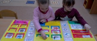
Fairy-tale characters are a great help with studying children's geography. In Russian folk tales, the main character travels all the time in search of his happiness, studying the customs and culture of other countries, and the terrain along the way. You can buy a “fairytale” geographical map or make it yourself.
In Russia, some fairy-tale characters have permanent residence places, for example, Cheburashka lives in Moscow, the house of Father Frost is in the city of Veliky Ustyug, etc. You can “settle” fairy-tale characters in the country where the fairy tale was written.
After hanging the map on the wall and looking at it every day with your child, name the continents, oceans, countries and their capitals. You can be sure that your child will never confuse Sweden with Switzerland, and will not look for the Amazon in Africa during a geography lesson at school.
Minerals
Our land contains many real riches and treasures. And this is also an interesting and important topic for discussion with your child. Why are natural resources called “minerals”? Fossils - because these riches need to be sought and dug out of the ground, and useful ones - because they bring great benefits to people. While preparing dinner with your little one, tell him about natural gas. But in the kitchen there is another valuable “fossil” - salt. Ceramic dishes are made from clay, glass from sand. All these are minerals.
Sitting by a fire in the forest, think about coal; when traveling in a car, think about oil. Walking around the city will introduce your baby to rocks such as marble and granite. They are widely used in construction. While doing creative work with your little one, tell them that earthly riches even help them make wonderful drawings. Multi-colored crayons for drawing on asphalt are a type of chalk rock. It was made from shells and parts of tiny plants and animals that lived many, many years ago. And the lead of a pencil, which leaves colored lines on paper, is made from a mineral called graphite.
Rings and beads are made of precious stones. These stones are very beautiful. They shine and shimmer in different colors. Such stones are rare in the ground and are expensive, which is why they are called precious. These are diamonds, rubies, emeralds, etc.
Try creating your own collection of minerals with your child. Most likely, you will not be able to find precious stones, but ordinary salt, coal, sand, chalk, graphite, etc. will rightfully take their rightful place in it.
“Development of geographical concepts in preschool children”
“Development of geographical concepts in preschool children”
Slide 1
“The basics of geography force you to become a poet! You can’t describe our bright planet with a dull word...” I.I. Landau
Geography has accompanied us since our birth. After all, we are born in a certain country, in a certain city or village, we live on a certain street and house. Here, at the threshold of our house, geography begins.
Therefore, I decided to choose this scientific and methodological problem for myself: “The development of geographical concepts in preschool children.”
Children and Geography... Some may say that school terms are not appropriate for preschoolers. Not at all, and I will try to show this in my work. An inquisitive child's mind absorbs all the information that interests him, especially if it is presented in the form of a game. My task is to develop in children an inquisitive mind, cognitive initiative, the ability to compare (distinguish and combine) things and phenomena, establish simple connections and relationships between them, expand children’s horizons, form geographical ideas and create conditions for this so that children could “step” beyond the boundaries of the already acquired environment and begin to be interested in “everything in the world.”
Starting work on this problem, I diagnosed the level of knowledge of children in the section “formation of elementary geographical ideas of preschoolers.” Having analyzed the results obtained, I came to the conclusion that it is necessary to integrate tasks for the development of geographical concepts into all types of children's activities.
The study of geography in kindergarten is very little advertised, the material needs to be collected bit by bit, using scientific and methodological literature in the form of children's encyclopedias, geographical fiction, board games, Internet resources... we really like to watch video material from the series “Shishkina School”, educational cartoons “Lessons from Aunt Owl”
Having selected available content and methods, taking into account general objectives, I made a long-term plan for introducing children to geographical ideas. First of all, I began to introduce children to our amazing planet: “Every person has his own home. You have it too. You live in it with mom and dad. But all, all people have one more big common home - our beautiful planet Earth. The sky is like a huge blue ceiling, and the ground we walk on is the floor. One big sun shines for everyone. The rain pours on us, like a shower, and the breeze blows across us. A long time ago, many, many years ago, people knew nothing at all about our planet. They thought that the Earth was like a big pancake and lay on the backs of three whales or three elephants, which stood on a giant turtle. When animals began to move, earthquakes occurred on Earth.”
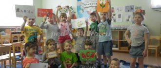
A real treasure trove of geographical knowledge is a variety of children's literature. A variety of children's literature contains a lot of interesting information, including geographical knowledge. (photos FICTION)
For example, a journey on the map is accompanied by reading works of fiction written by storytellers from different countries: the Brothers Grimm - Germany, Charles Perrault - France... So, reading about Carlson's tricks, we will find the country of Sweden on the map. Reading the well-known fairy tale “Little Red Riding Hood”, we will tell you what its storyteller, Charles Perrault, who lived in France, wrote. When we are going to read the fairy tale “Cipollino”, we will find on the map Italy - the country of the storyteller Gianni Rodari. Kipling's tales will introduce little geographers to the animal world of India. Traveling with Doctor Aibolit, children get acquainted with the fauna of Africa. It is very good if books are rich in illustrations, biological and historical objects.
My work consists of project activities, which are aimed at studying corners of the world, continents, continents, seas, oceans, etc. We determine the duration of the topic based on the interest of the children, approximately 1-2 weeks. Here are some of them: “Journey to the continents of the Earth”, “Riches of the Earth’s interior” (Minerals, chalk, earth, water, sand, clay). , “North Pole”, “The Country in Which It’s Always Summer”, “Journey on the Ocean”, “Underwater World”, etc.
In a playful way, it is much easier for preschool children to master the natural and cultural symbols of different parts of the world: for example, while traveling around Antarctica, we learn about icebergs, penguins, conduct experiments with ice, find out why it is always cold in Antarctica, consolidate knowledge by drawing, doing origami
In mysterious India, the children liked the temples, the Taj Mahal Temple. The colorfulness of the national clothes. We even learned Indian dance. We learned to draw a rangoli - a drawing of happiness from cereals, colored rice, flour. We learned about the symbol - an elephant with a raised trunk, bringing prosperity and health to the house, sculpted it from salt dough. Such trips help to master the cardinal directions, get acquainted with the compass, learn the names of the seas and oceans, compare the flora and fauna of different climatic zones, find out what kind of people live there, what they do, what kind of houses and architectural monuments they have.
Our land contains many real riches and treasures. And this is also an interesting and important topic for discussion with preschoolers. Why are natural resources called “minerals”? Fossils - because these riches need to be sought and dug out of the ground, and useful ones - because they bring great benefits to people. While drawing with my children, I tell them that earthly riches even help them make wonderful drawings. Multi-colored crayons for drawing on asphalt are a type of chalk rock. It was made from shells and parts of tiny plants and animals that lived many, many years ago. And the lead of a pencil, which leaves colored lines on paper, is made from a mineral called graphite.
In my work on studying geography at preschool educational institutions, I touch on different areas of the educational process according to Federal State Standards. While studying the beauty of nature, sunsets, sunrises, we learned to draw landscapes using the method of S.V. Pogodina, very interesting drawing techniques.
Children love geographical riddles and jokes: - What city can be in the air? (Eagle) - Which city is the angriest? (Grozny) - Which city is the sweetest? (Raisin) - Which island considers itself clothing? (Jamaica) - Between what two letters can you put a small horse to get the name of a country or island? (Japan) - What city does blood flow through? (Around Vienna)
Which seas have colored names, why were they given such names? The name “Black” Sea received due to the fact that in ancient times this word had the meaning “inhospitable”: so
A prerequisite for achieving the goals of the project is working with parents. Parents should know what teachers teach children and support children's interest and curiosity. :
Conducted consultations with them, trainings, joint exhibitions, open viewings, organization of a development environment, topics
Some consultations: “Geography for kids”, “Should we go to the zoo?”, “Geography in a saucepan”, etc. Educational literature, booklets, educational magazines, children's works on this topic were placed on the information stand. At a parent meeting, she introduced me to the scope of knowledge in the field of geography.
An interesting technique when introducing geography is to invite children to talk about their travels to other cities and countries, what interesting things they saw, what struck them most, what souvenirs they brought from there, and show children photographs of memorable places. Children relive the emotions of the trip and learn to tell their friends about them.
Studying the native land using the example of our city, district. The native land is a small world from which a child’s acquaintance with the big world begins. It is very important to develop in children an understanding that their native land is a part of a great power. And when children learn to love and preserve the region where they live, they will also treat the various beautiful places throughout the country.
Besides classes and games, where else can you study earth science? Of course, on a walk. We simply draw children’s attention to the world around them and tell them. For example, about soil. What is black soil, how is it formed, what plants grow on it. What plants grow on sand? What is better for plants: black soil, sand or clay? How do they differ in their properties? You can take a compass with you for a walk - a necessary device for a traveler. This is a great opportunity to introduce children to parts of the world. Children should know that in the morning the sun rises in the East, and in the evening it sets on the other side - in the West.
Subject to systematic work at the end of the school year, the following results are expected: - Formation of elementary natural scientific ideas about the Earth in children of senior preschool age; - Increasing interest in nature and caring attitude towards planet Earth; - Children use special terminology in their speech, replenish their vocabulary with geographical concepts; - Children’s level of observation increases; — Children know how to draw conclusions and put forward hypotheses; The final stage is pedagogical monitoring of tracked indicators. In general, we can note the positive result of the work, expressed not only in the growth of the volume of geographical ideas among preschoolers, the expansion of general ideas about the processes of development and formation of geography, the accumulation of geographical information, but also in awakening interest in the surrounding nature, awareness of the connections and dependencies between nature and society and man, nurturing love for the Motherland, native land. By studying geography, we teach friendship of all peoples of the Earth!